View Device Details
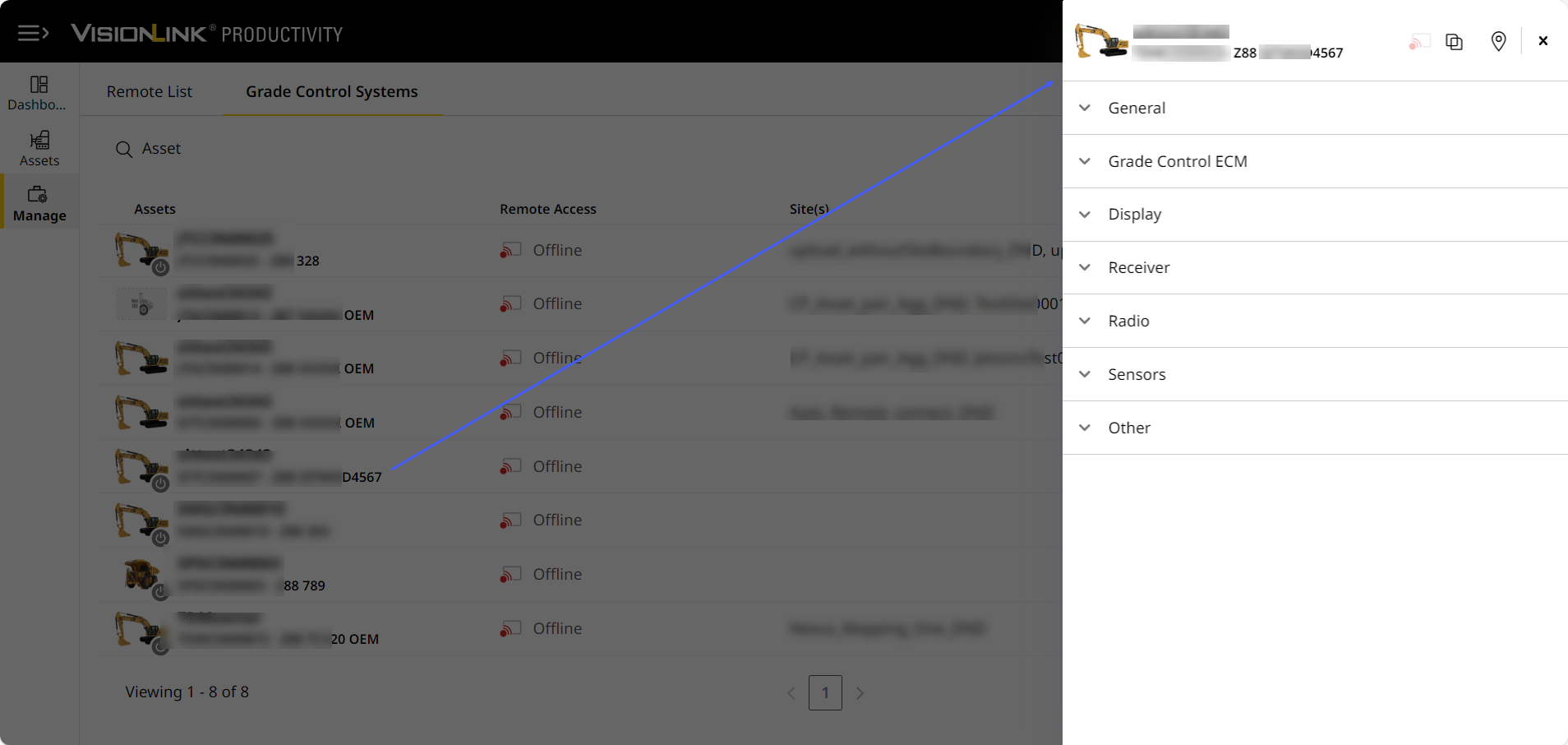
On Grade Control Systems, you can click more options ![]() of an asset of interest > Device Details to view the status of its paired grade control device (GCD). This lists all available device parameters with the latest values.
of an asset of interest > Device Details to view the status of its paired grade control device (GCD). This lists all available device parameters with the latest values.
With this, you can quickly learn about your asset's attached grade control devices. This helps you take corrective actions and perform further investigations if needed.

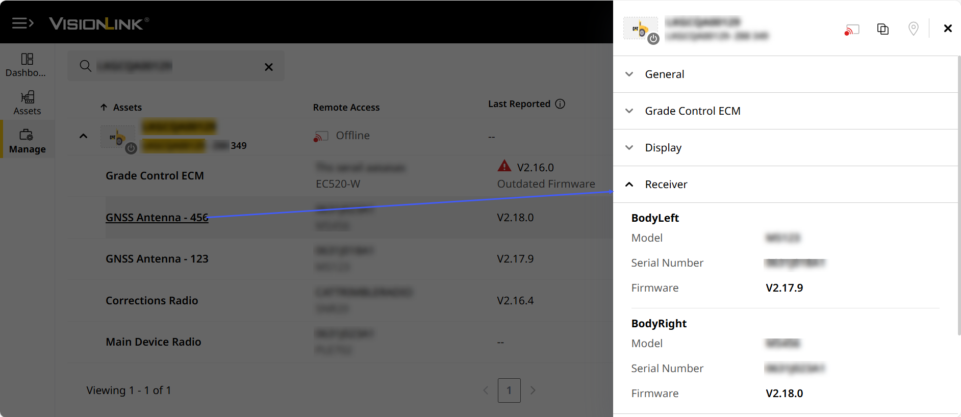
Quickly access device details by clicking on the respective linked device in the drop-down list.
View ImageView Image

• You can only view the status for EC520 grade ECM devices your asset is paired with.
• Upgrade to GCD version to v2.16 firmware or above to access your asset's device details on VisionLink Productivity.
• The status updates every ten minutes the asset is keyed on. Manually refresh the page to view the latest data.
From here, you can perform the following:
View ImageView Image
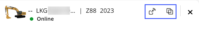
• Remotely access ![]() your asset through the Cat Grade system. If the asset is offline, this option will be grayed out.
your asset through the Cat Grade system. If the asset is offline, this option will be grayed out.
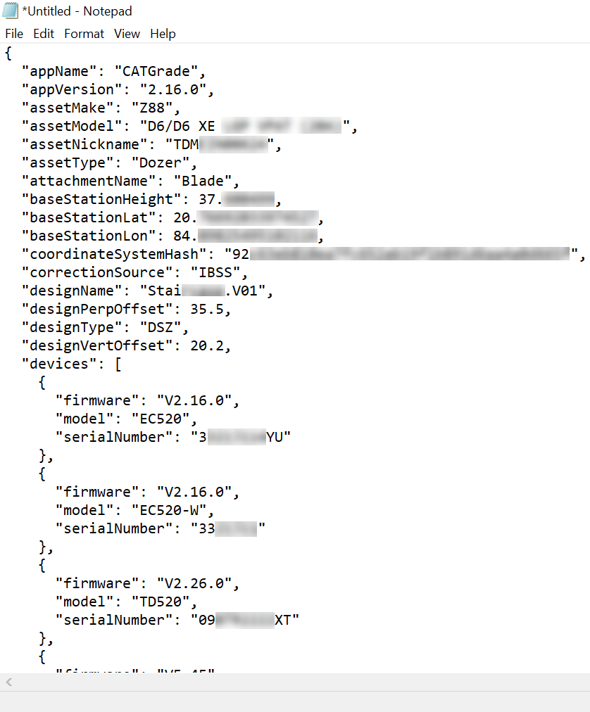
• Copy ![]() the GCD status as a .json file and paste it where you prefer (text editor applications or email). The pasted content displays with the same formatting as the .json file. This will help you further analyze and share with others.
the GCD status as a .json file and paste it where you prefer (text editor applications or email). The pasted content displays with the same formatting as the .json file. This will help you further analyze and share with others.
View ImageView Image
• Locate ![]() the asset on map view and get directions.
the asset on map view and get directions.
VisionLink Productivity categorizes the device parameters into distinct sections. This helps you quickly scan and navigate to the information most vital to you. The following are the sections and parameters:
• The sections and parameters displayed will vary depending on asset, it’s configuration and paired GCD. It also depends on what available data is sent to the application.
• If data is not available, then that parameter or section won’t be present.
-
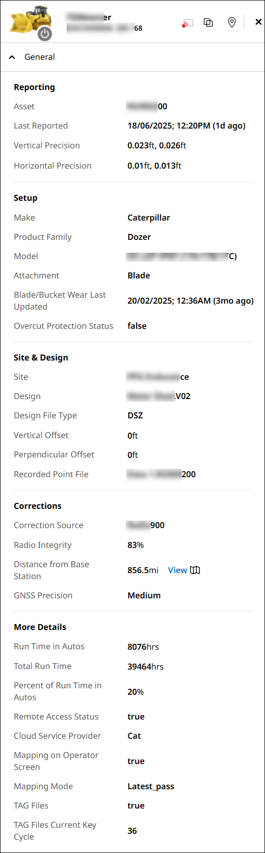
General: Displays essential GCD-related information.
-
Reporting: Shows date and time when asset last reported its status. Either displays in local or UTC timezone.
-
Asset
-
Last Report: Shows date and time when asset last reported its status. Either displays in local or UTC timezone.
-
Vertical Precision: Displays vertical elevation measurements by utilizing the main antenna.
-
Horizontal Precision: Displays horizontal elevation measurements by utilizing the main antenna.
-
-
Setup
-
Make
-
Product Family
-
Model
-
Attachment
-
Blade/Bucket Wear Last Updated: Shows the date and time when blade (for dozers and motor graders) and bucket (for excavators) were last updated.
Accuracy of this data depends on operators notifying the system of blade/bucket replacement. -
Overcut Protection Status: Displays if overcut protection is enabled or not, affecting how the blade/bucket interacts with the target surface.
-
If enabled, blade/bucket is prevented from cutting too deep.
-
If disabled, unrestricted digging is allowed.
-
-
-
Site & Design
-
Site
-
Design: Displays name of the design file added to the asset.
-
Design File Type
-
Vertical Offset: Displays distance of the vertical offset.
-
Perpendicular Offset: Displays distance of the perpendicular offset.
-
Record Point File: Displays the file name of the last recorded point.
-
-
Corrections
-
Correction Source: Displays the source (radio-, internet-, or satellite-based) that sends corrections for positional adjustments.
-
Radio Integrity: Displays percentage of radio signal working as expected.
-
Distance from Base Station: Shows the distance of the asset from the base station. The closer the asset is to the base, the more accurate the data.
• Click View to visualise the distance between base station and the asset on map view.
View ImageView Image
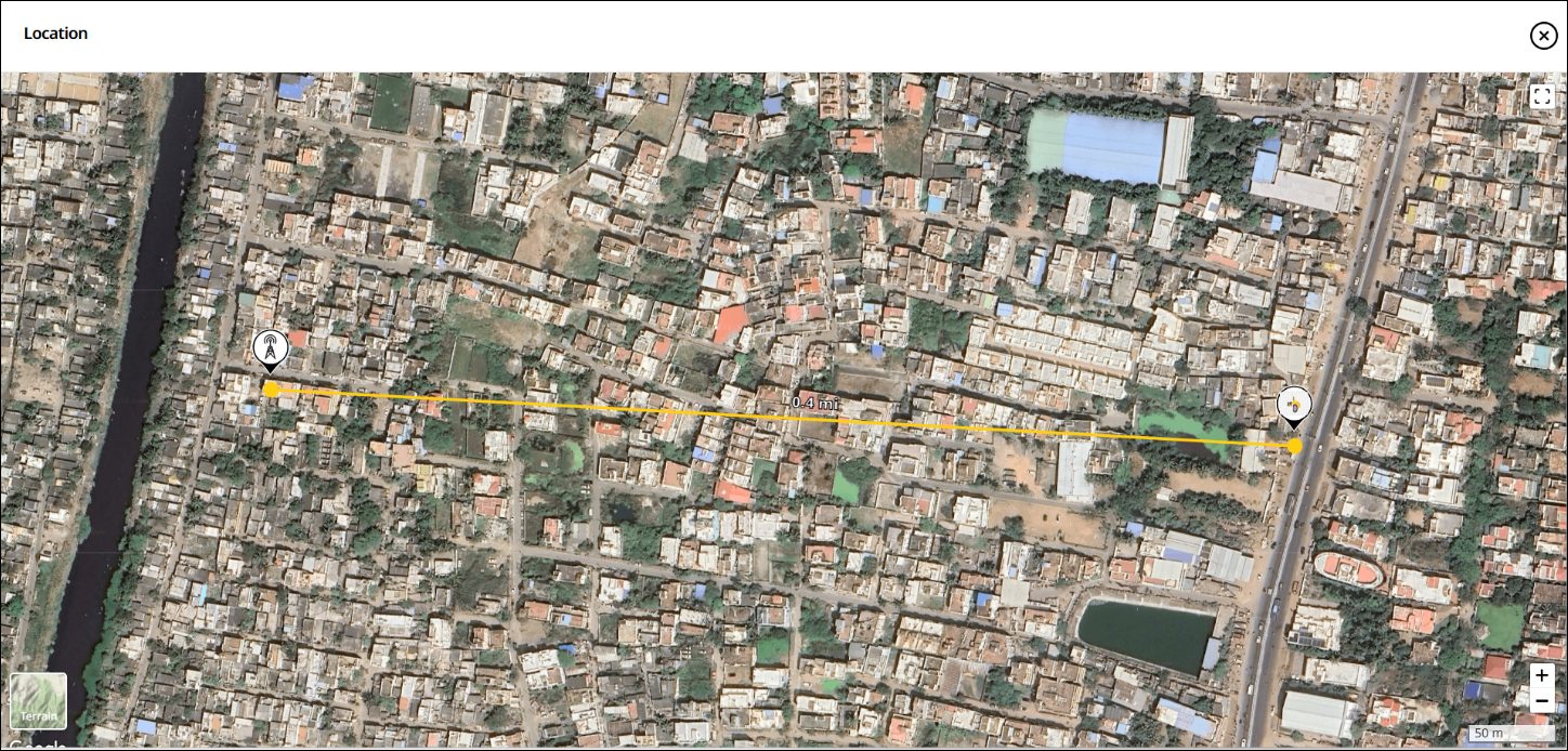
• On map view, click Get Directions to launch Google Maps to get the coordinates, directions and other details.
• The minimum distance between an asset and its base station (for accurate data collection) depends on the correction method type used:
° 900 MHz radio corrections, it is effective up to 2 miles.
° 450 MHz radio corrections, it is effective up to 15 miles.
° For Internet-based corrections (NTRIP), it is effective up to 6 miles.
° Environmental factors like buildings and hills may also obstruct signals. Thus, these may also influence the minimum distance value. -
GNSS Precision: Displays the preset tolerance values for Global Navigation Satellite Systems (GNSS) based on the vertical and horizontal precision for asset to run in Autos mode. These tolerance presets serve as predefined accuracy levels. They ensure that the asset precision stays within set tolerance thresholds
Following are the three available accuracy levels:
• Fine: Helpful for high-precision tasks, such as fine grading with motor graders.
• Medium: Suitable for bulk earthworks and rough grading. Often used in dozers.
• Course: Ideal for compaction mapping, typically applied in compactors.
-
-
More Details
-
Run Time in Autos: Displays total duration for which the grade system runs in Autos.
-
Total Run Time: Displays total duration for which the grade system remains switched on.
-
Percentage of Run Time in Autos: Displays percentage of time that the grade system runs in Autos.
-
Remote Access Status: Displays if remote access is enabled or not.
-
Cloud Service Provider: Shows which cloud service the asset is subscribed to: VisionLink or Trimble.
-
Mapping on Operator Screen: Shows if operator has enabled or disabled screen mapping on the onboard display.
-
Mapping Mode: Shows how the asset’s mapping mode is set up. Mapping Mode is an asset-specific setting that visualizes operational data through heat map overlays.
It varies based on the type of asset used:
• Compactors: Features multiple compaction mapping mode.
• Excavators: Use a minimum elevation setting to map the bucket position accurately.
• Dozers and Motor graders: Relies on the latest pass to track grading work. -
TAG File: Displays if system is sending .tag file to the selected cloud service.
-
TAG Files Current Key Cycle: Displays number of .tag files transferred since last cycle.
-
-
-
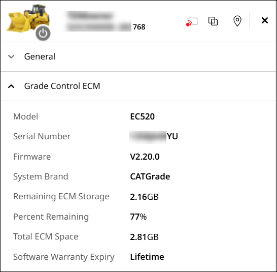
Grade Control ECM: Displays information related to the GCD.
-
Model
-
Serial Number
-
Firmware
-
System Brand
-
Remaining ECM Storage: Displays available free space on the GCD.
-
Percentage Remaining: Displays percentage of remaining storage on the GCD.
-
Total ECM Storage
-
Software Warranty Expiry: Date when the software warranty expires. For CAT EC520, it shows Lifetime, while for Trimble EC520, the software expiry displays.
-
-
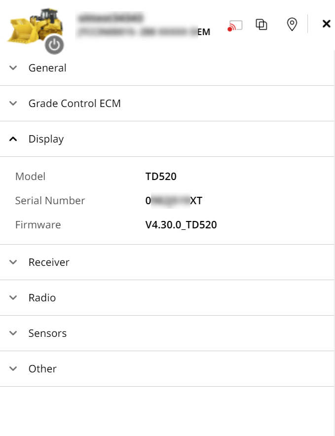
Display: Provides information related to model, serial number and frequency of the asset’s onboard display.
-
Model
-
Serial Number
-
Firmware
-
-
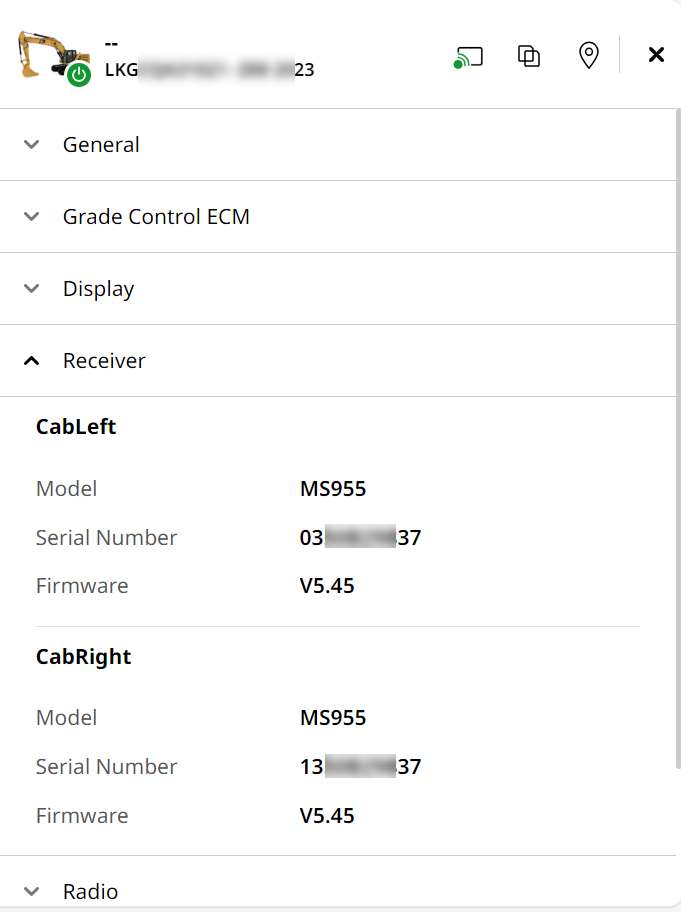
Receiver: Provides information related to cabs.
-
Cab Left: Shows details of the main receiver receiving base station’s satellite information.
-
Model
-
Serial Number
-
Firmware
-
-
Satellites: Displays the total number of satellites used by cab left to calculate asset's position.
-
GPS: Displays United States’ satellite navigation system details.
-
GLONAS: Displays Russia’s satellite navigation system details.
-
BeDou: Displays China’s satellite navigation system details.
-
Galileo: Displays Europe’s satellite navigation system details.
-
QZSS: Displays Japan’s satellite navigation system details.
-
-
Cab Right: Shows details of the receiver connected to the main receiver.
-
Model
-
Serial Number
-
Firmware
-
-
Satellites: Displays the total number of satellites used by cab right to calculate asset's position.
-
GPS
-
GLONAS
-
BeDou
-
Galileo
-
QZSS
If satellite doesn't have available data, this option will be disabled.
-
-
Electric Mast: Displays details of the mounting structure positioning GNSS antennas and UTS Prisms for data collection and navigation.
-
Model
-
Serial Number
-
Firmware
-
-
-
Radio: Displays information related to radio and modems functioning on the asset.
-
Corrections Radio: Displays radio details that transmits the correction data to the asset’s receiver.
-
Model
-
Serial Number
-
Firmware
-
-
Main Device Radio: Displays details of primary radio attached to the asset.
-
Model
-
Serial Number
-
Software Part Number
-
-
Tethered Cellular Radio: Displays details of cellular radio connected to the GNSS receiver.
-
Model
-
Serial Number
-
Software Part Number
-
-
3rd Party Modem: Displays details of Trimble internet modem that provides internet to the device.
-
Model
-
Serial Number
-
Firmware
-
-
_2.png)
-
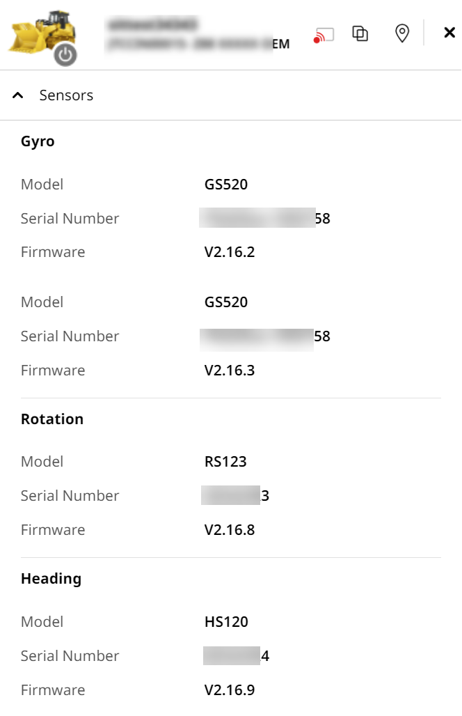
Sensors: Provides information on all the asset’s sensors.
-
Gyro
-
Model
-
Serial Number
-
Firmware
-
-
Angle
-
Model
-
Serial Number
-
Firmware
-
-
Rotation
-
Model
-
Serial Number
-
Firmware
-
-
Heading
-
Model
-
Serial Number
-
Firmware
-
-
-
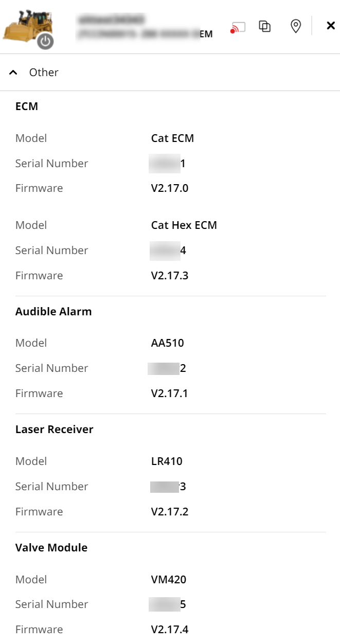
Other: Lists miscellaneous information not covered in prior sections.
-
ECM
-
Model
-
Serial Number
-
Firmware
-
-
Audible Alarm
-
Model
-
Serial Number
-
Firmware
-
-
Laser Receiver
-
Model
-
Serial Number
-
Firmware
-
-
Valve Module
-
Model
-
Serial Number
-
Firmware
-
-