Uploading Geodata Files
Geodata files are sometimes used when site calibrations are created. If a surveyor uses a geodata file (like a geoid file) when creating the calibration file (.cal), the geoid files need to be uploaded to the asset.
These files ensure more accurate reporting of site and asset data.

• To know more about geodata files, reach out to your project’s survey manager.
• You must also upload calibration and CoordSystemDatabase.xml files to the relevant site as well.
• The geoid, calibration and CoordSystemDatabase.xml file names should match, both offboard (on the application) and onboard the asset.
• Any .xml file not named as CoordSystemDatabase.xml can only be uploaded as a design file.
• You can only upload one calibration and geoid file type per site. If you want to re-upload a geoid file of a particular file type, you’ll need to delete the existing one first.

For an optimum experience while using geoid files, upload files in the following order:
1. Calibration file
2. Geodata file
3. CoordSystemDatabase.xml file
Uploading Geodata Files
To upload geodata files:
-
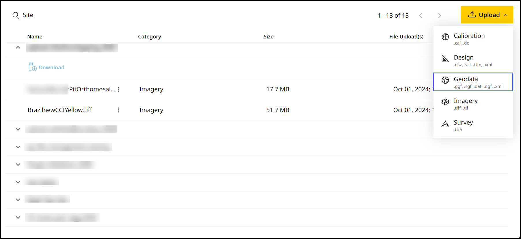
On Files, click
 > select Geodata.
-
Select the desired site from the Site Name drop down.
On the Site Name drop down, you can search for your desired site in case to quickly find and select them.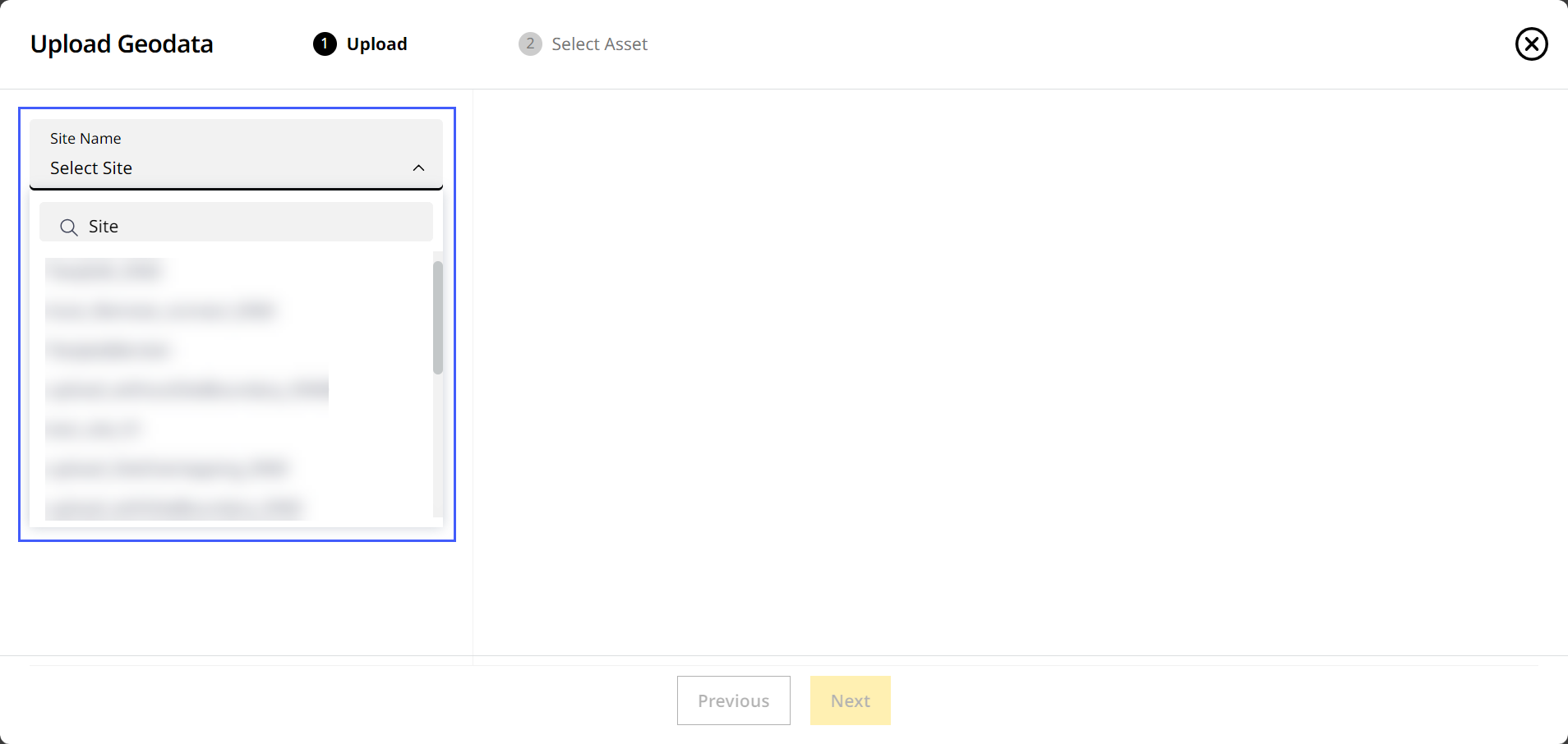
-
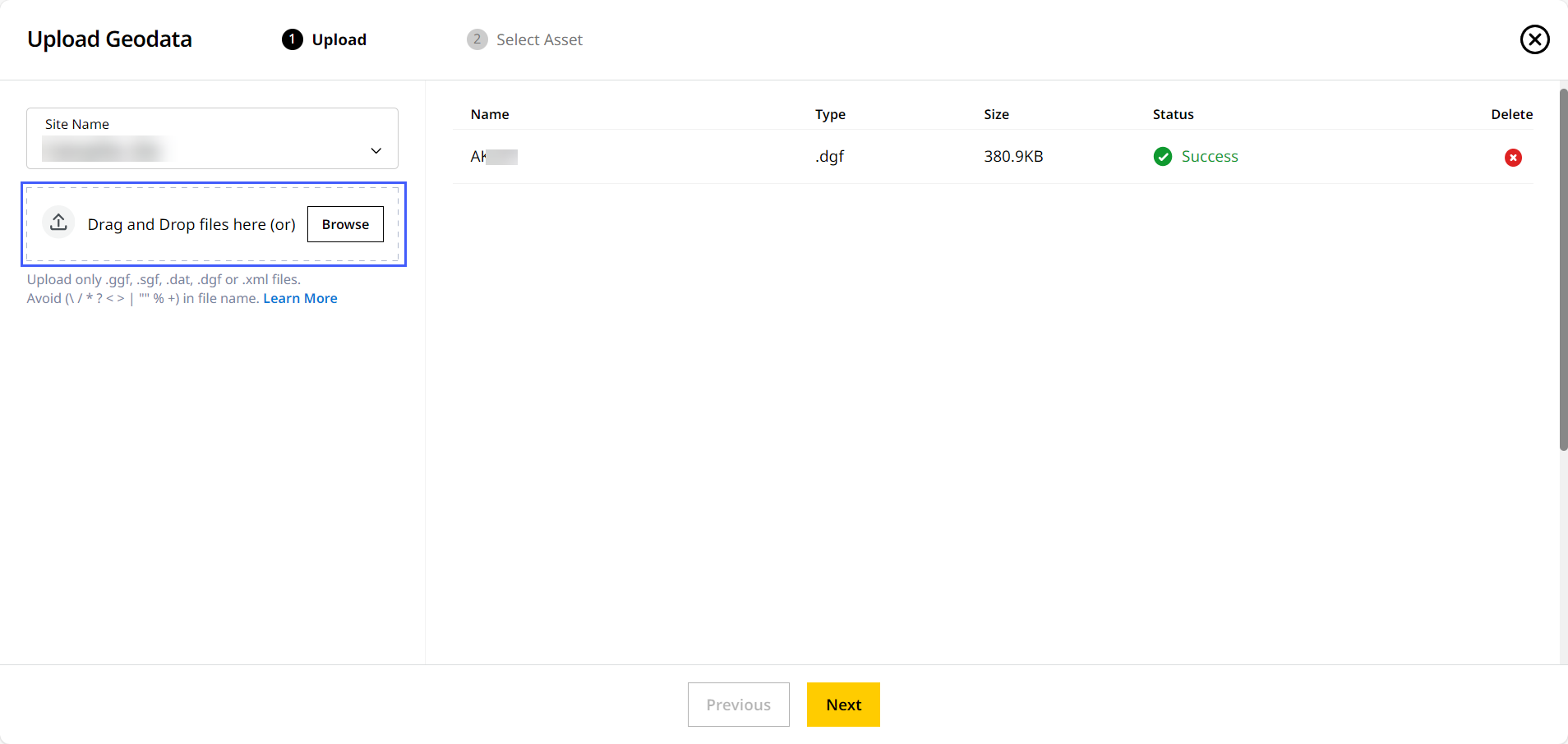
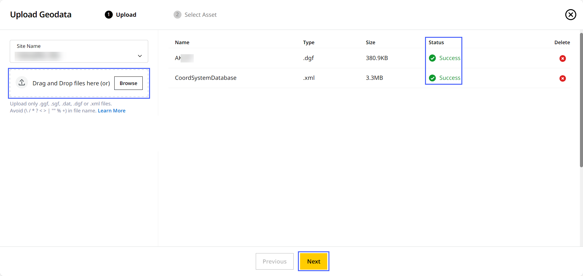
Drag and drop the file from your device or click Browse to find the file.
-
Geodata file
• Your site may already have a calibration file uploaded prior. If so, you can upload geodata file without it referenced in the calibration file.
◦ If a calibration file references a specific geoid, the referenced geoid (.GGF) file must be uploaded to ensure the calibration can be used on the asset.
• Only one geodata file of each file type can be uploaded to a single site at time. Delete the existing geodata file of a particular file type before uploading another one of the same type.
• Ensure the geodata file has the specific geodata file with file name referenced.
• You can upload either published or custom geodata files of the following file types: .ggf, .sgf, .dat and .dgf.
◦ If you’re uploading a custom geoid file, ensure you’ve edited the CoordSystemDatabase.xml file to reference the same.-
Give it a few minutes for the upload to be completed.
-
-
Relevant CoordSystemDatabase.xml file:
• The CoordSystemDatabase.xml file should be referenced in both the geodata and calibration files uploaded to that site.
• For custom geoid files, you’ll need to update the CoordSystemDatabase.xml file accordingly.
• Under Upload Geodata, you can only upload CoordSystemDatabase.xml files. No other .xml files are supported. To upload other .xml files, refer to Uploading Design Files.-
Give it a few minutes for the upload to be completed.
-
A successful upload of the file will be denoted in the Status column. Click Next to proceed.
-
-
-
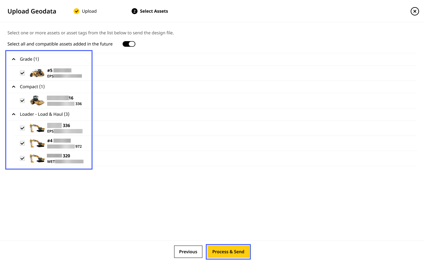
On the Select Assets step, choose the assets where you want to send the uploaded files. Click Process & Send to proceed.
Click toggle on to select all assets in the list below and any more compatible assets added to the site in the future. This ensures the file will be synced to all of them going forward.