Edit CoordSystemDatabase.xml File for Custom Geoid Files
The CoordSystemDatabase.xml file provides grade or earthwork coordination details for a site. It helps ensure the geoid and calibration file are correctly up-to-date and accurate.
![]() Caution:
Caution:
• Ensure that the CoordSystemDatabase.xml file name doesn't change or isn't edited. The application and grade system uses the name "CoordSystemDatabase.xml" to verify if all required elements are present.
• If the .xml file has any other name, the application will consider it as a design (landXML) file and auto-assign it under the Design category. Ensure the file is named accordingly.
If your site uses a custom geoid file, you will need to add the file name and details to the CoordSystemDatabase.xml file. This is only for custom geoid files not included in the existing database.
If your custom geoid file doesn't load on your asset display, you'll get the following error message:
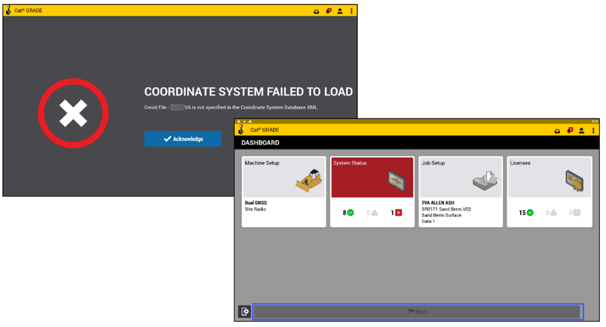
Please contact your site survey manager if you get the above error. This means that the custom geoid file is not specified in the CoordSystemDatabase.xml.
The survey manager will need to do the following:
-
Add the custom geoid file details to the CoordSystemDatabase.xml file.
-
Upload the modified CoordSystemDatabase.xml file to the asset’s GeoData folder.