Uploading Imagery Files
Imagery files work as site images, helping you add layers to the existing map view across the application.
This allows for more accurate understanding and clarity of your site along with its terrain, zones and events.
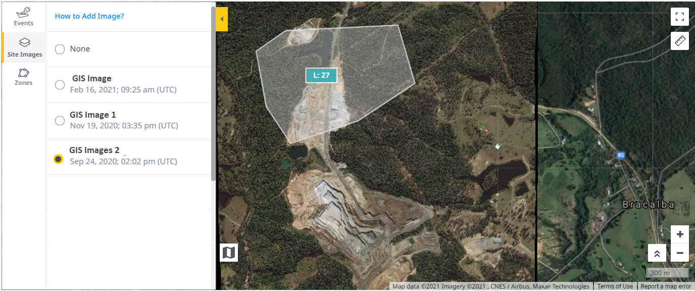

You can zoom into the uploaded images from 15 to 20 levels (extended from site view to lane view).

• The site image should have a known EPSG published coordinate system (e.g., EPSG:4326) and bounding values with RGB coverage information.
• Currently there is no support for local coordinate systems when uploading these imagery files.
• Imagery files will be uploaded as is. Any trimming or editing needs to be completed prior to uploading.
• You can also copy a processed imagery file to another site within your account.
• Unlike other file categories, you can upload imagery files only to the site. It cannot be synced or sent to the site’s assets.
Uploading Imagery Files
To upload imagery files:
-
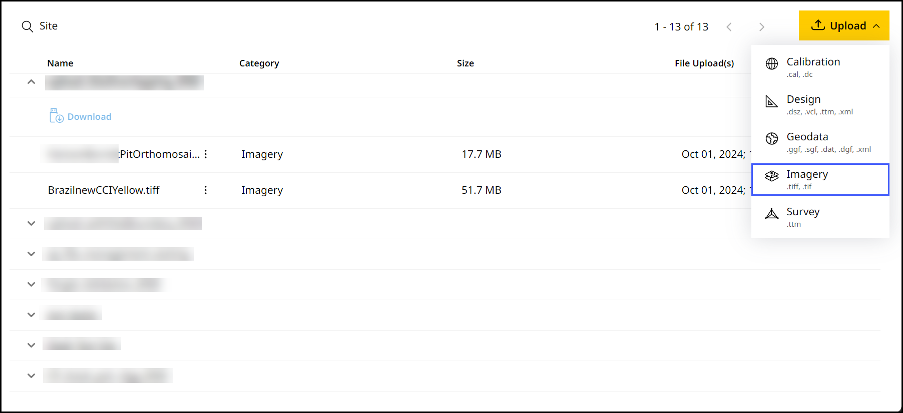
On Files, click
 > select Imagery.
-
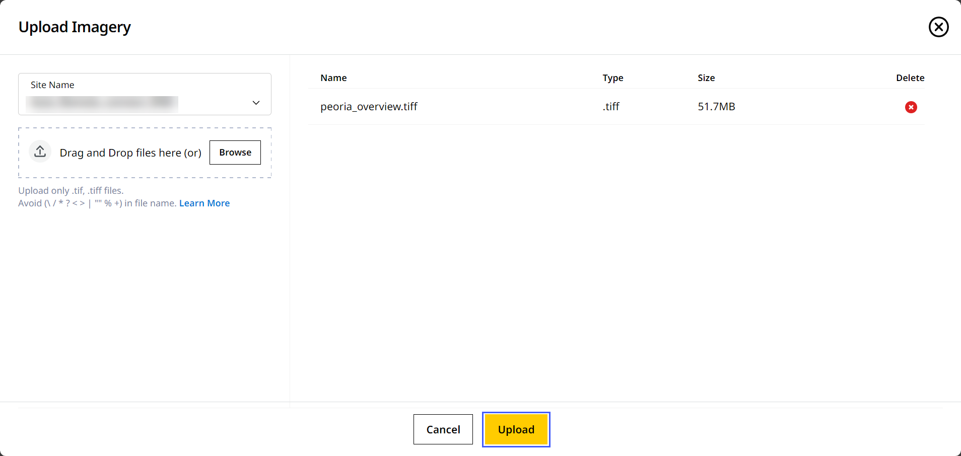
Select the desired site from the Site Name drop down.
On the Site Name drop down, you can search for your desired site in case to quickly find and select them.
-
Drag and drop the file from your device or click Browse to find the file.
On Upload Imagery, you can only upload .tiff/.tif file types.
For imagery files, you can upload multiple files at the same time.
-
Click Upload to complete the process.
-
Give it a few minutes for the file(s) to upload.
