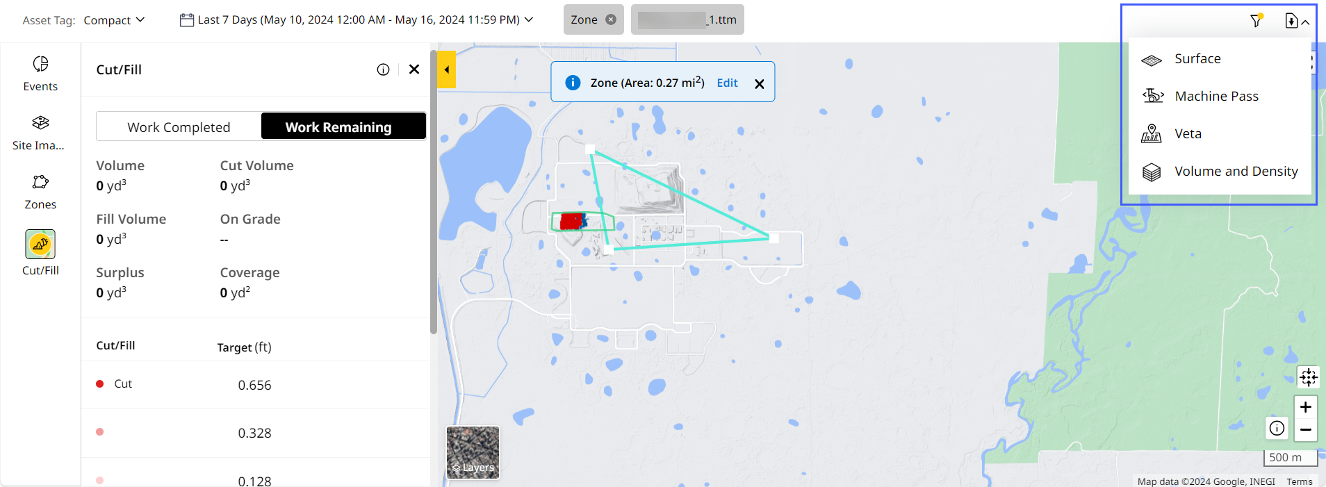
Download Map (Insights) Tab Reports
For Grade and Compact assets, you can download multiple report types containing the latest machine pass, surface, veta and volume plus density information to further analyze and share.
To access this, navigate to Insights > Map (Insights).
Surface 
Allows you to download the latest machine data on a graded surface as a .ttm file. Download the surface report for the selected date and time range. Share and further analyze these reports.
Machine Pass 
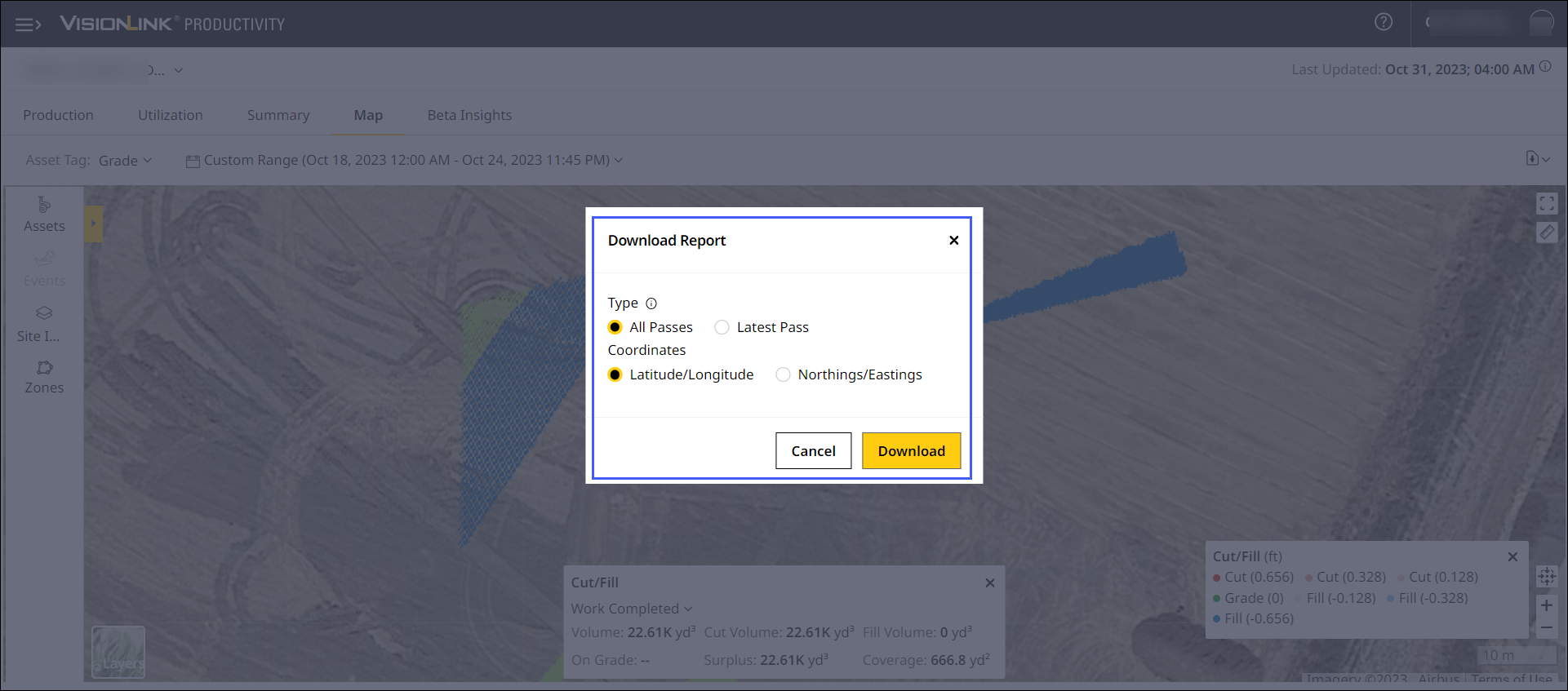
Allows you to download the latest or all machine pass information on the graded surface as a .csv file you can share and further analyze. To download machine pass data:
-
Select Type as All Passes or Latest Pass.
-
Select Coordinates as Latitude/Longitude or Northings/Eastings.
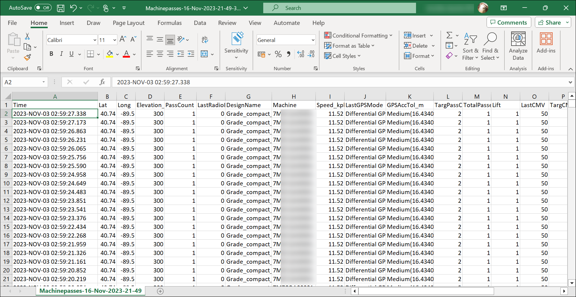
Here is a sample Machine Pass report:
Veta 
Veta is a 3rd party application which allows much more detailed compaction data analysis that is commonly used for projects or sites that have strict compaction compliance requirements. You can download a detailed compaction analysis report for grade or compact assets that can be read and processed by Veta-supported applications.
Select Coordinates as Latitude/Longitude or Northings/Eastings.
Download the Veta report for the selected date and time range as a .csv file to share and further analyze. The columns in the downloaded report are mandated by the consuming application, which are:
-
Time
-
Latitude
-
Longitude
-
Elevation
- Pass number
-
Last radio latency
-
Design name
-
Machine
-
Speed
-
Last GPS mode
-
GPS AccTol_m
-
Target pass count
-
Valid pos
-
Lift
-
Last CMV
-
Target CMV
-
Last MDP
-
Target MDP
-
Last RMV
-
LastFreq_Hz
-
LastAmp_mm
-
TargThickness_FT
-
Machine gear
-
Vibe state
-
LastTemp
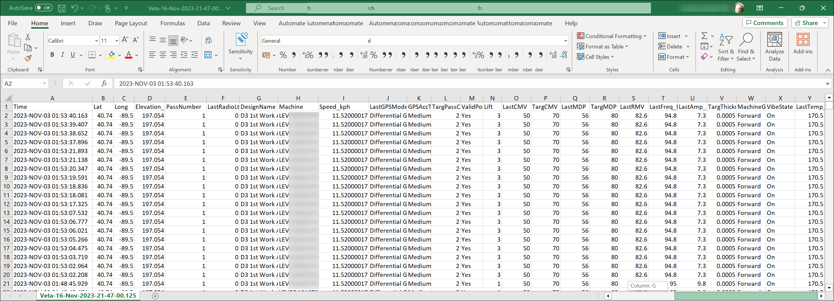
Here is a sample Veta report:

• This feature is available only for sites with a calibration file.
• Download ![]() is disabled when there is no corresponding Insights data for the selected date range.
is disabled when there is no corresponding Insights data for the selected date range.
• Do not refresh or close the page while download is in progress.
Volume & Density
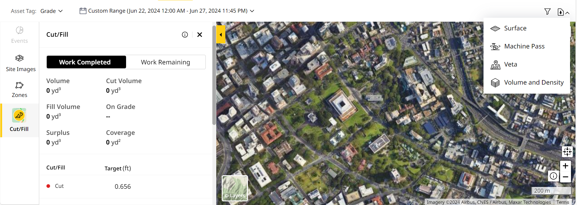
On Map (Insights), you can download the following two types of Volume & Density report:
- A report based on selecting any of the available Map Details. This downloads volume and density data for the affected areas coming under the map detail.
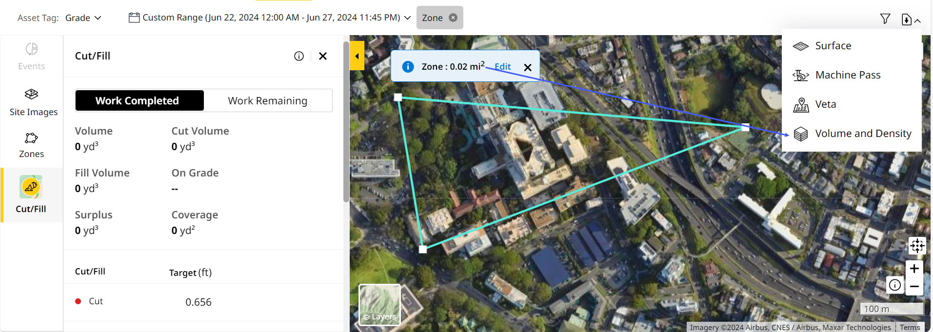
- A report based on the created custom temporary zone with Map Tools > Zones. This downloads volume and density data for that zone’s area alone.
• To prevent errors while downloading the report, ensure that
◦ you avoid overlapping or intersecting the zone boundaries and
◦ the date range doesn’t exceed 31 days.
• If you’re editing the zone size after creating, save edits so as to download the report.
View ImageView Image
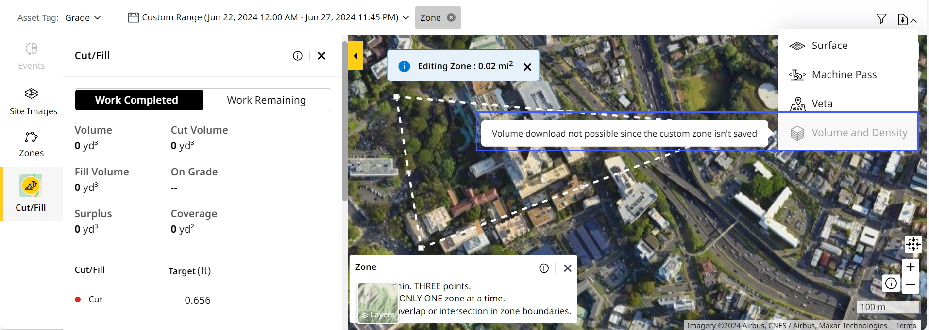
• The larger the selected zone area, the longer it will take for the map view to load and report to download.
• If you’ve applied filters to the zone, the same will carry forward into the report.
• You can also schedule reports for volume and density data. This can be for the custom zone created or for the entire site. Refer to Volume & Density to know more.
Access this data as a .csv file for the work completed and remaining within the corresponding region. The file contains the following information (with measurement units set as per your preference):
-
Selected dates
-
Area
-
Volume
-
Weight
-
Density
Here is a sample Volume and Density report:
 Report.png)